With iOS 14, Apple is going to update Apple Maps with some important new features, such as cycling directions, electric vehicle routing and curated guides. But the app is also going to learn one neat trick.
In dense areas where you can’t get a precise location, Apple Maps will prompt you to raise your phone and scan buildings across the street to refine your location.
As you may have guessed, this feature is based on Look Around, a Google Street View-inspired feature that lets you… look around as if you were walking down the street. It’s a bit more refined than Street View as everything is in 3D so you can notice the foreground and the background.
Look Around is only available in a handful of U.S. cities for now, such as San Francisco, New York, Chicago, Washington, DC, Las Vegas, etc. But the company is still expanding it with Seattle coming on Monday and major Japanese cities this fall. Some areas that are only accessible on foot will also be available in the future.
When you scan the skyline to refine your location, Apple doesn’t send any data to its servers. Matching is done on your device.
When it comes to guides, Apple has partnered with AllTrails, Lonely Planet, The Infatuation, Washington Post, Louis Vuitton and others to add curated lists of places to Apple Maps. When you tap on the search bar and scroll down on the search card, you can see guides of nearby places.
When you open a guide, you can see all the places on the map or you can browse the guide itself to see those places in a list view. You can share places and save them in a user-made guide — Apple calls it a collection in the current version of Apple Maps.
You can also save a curated guide altogether if you want to check it out regularly. Places get automatically updated.
Image Credits: Apple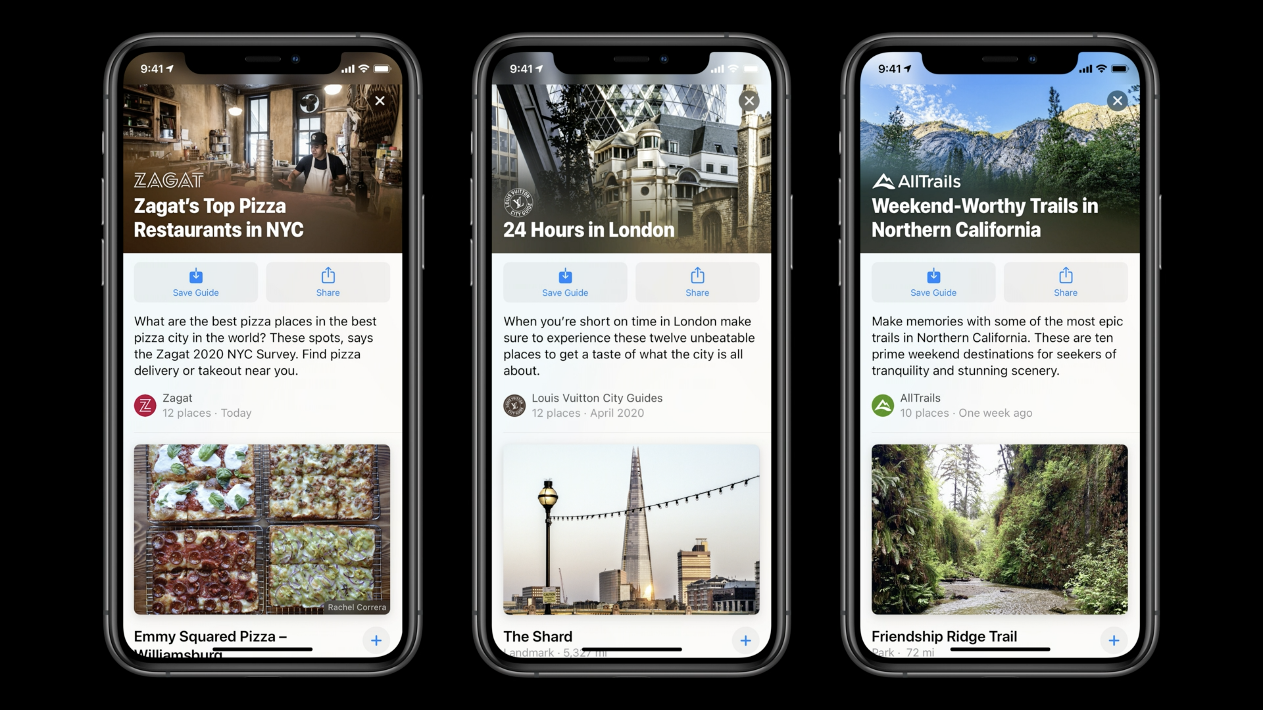
As for EV routing, Apple Maps will let add your car, name it and choose a charger type — Apple has partnered with BMW and Ford for now. When you’re planning a route, you can now select the car you’re going to be using. If you select your electric car, Apple Maps will add charging spots on the way. You can tap on spots to see if they are free or paid and the connector type.
Waze users will also be happy to learn that Apple Maps will be able to warn you if you’re exceeding the speed limit. You can also view speed and red light cameras on the map.
In some cities with congestion zones and license plate access, you’ll be able to add your license plate. The information is kept on the device. It’ll refine directions for those cities.
Image Credits: Apple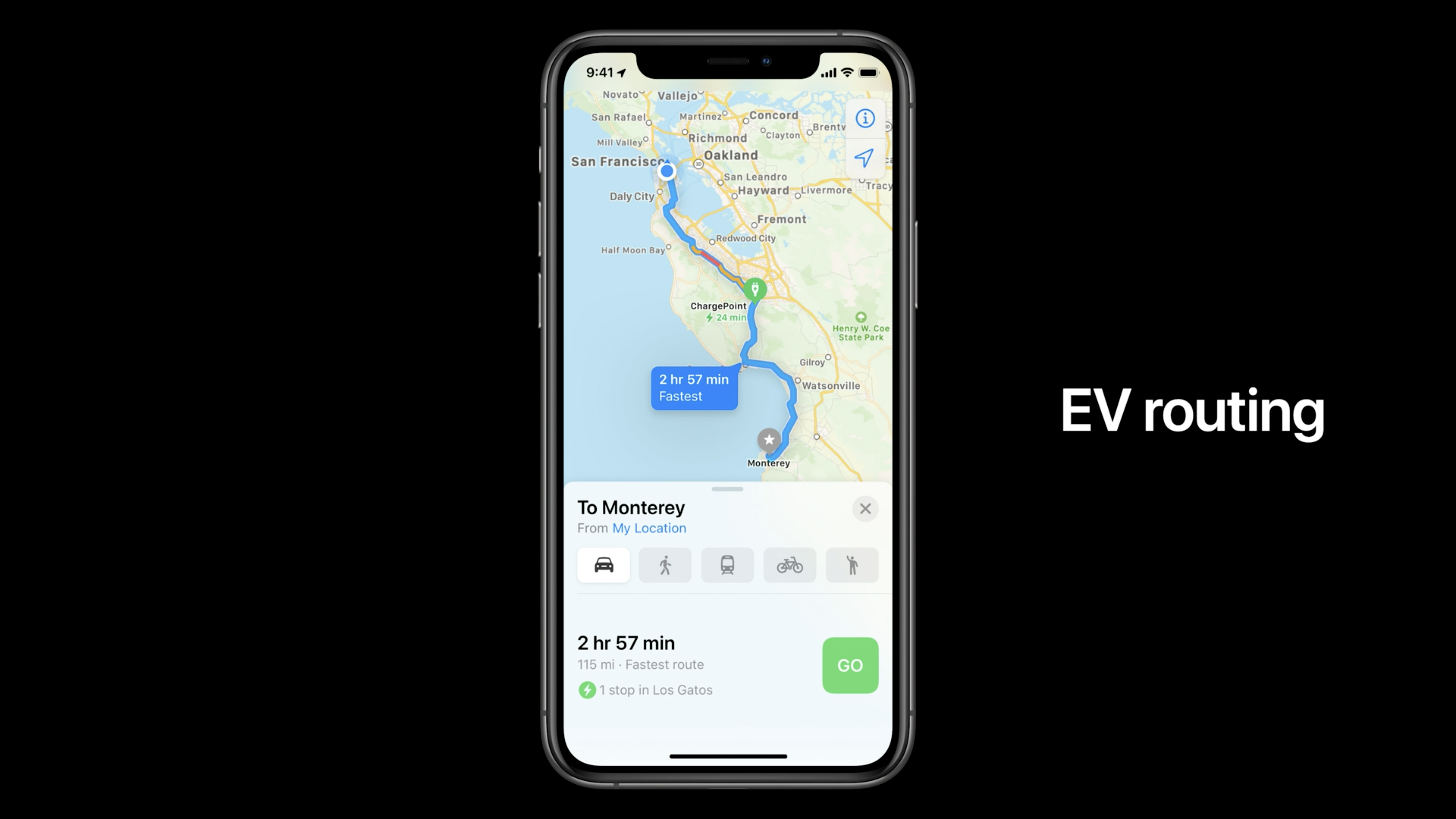
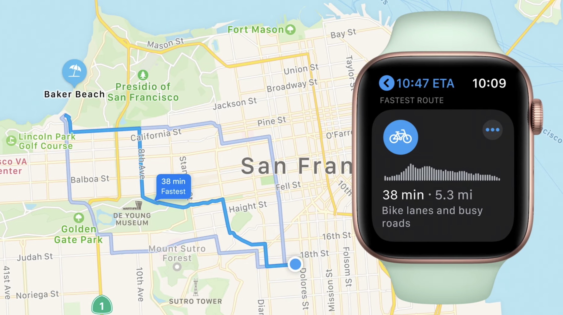
Finally, my favorite new feature is cycling directions. It’s only going to be available in New York City, Los Angeles, San Francisco, Shanghai and Beijing at first. Apple ticks all the right boxes, such as taking into consideration cycling paths and elevation. Turn-by-turn directions look slightly different from driving directions with a different framing and a more vertical view.
Google Maps also features cycling directions, but they suck. I can’t wait to try it out to see whether cycling directions actually make sense in Apple Maps. The new version of Apple Maps will ship with iOS 14 this fall.
Image Credits: Apple